Pace Bend

Trail
6.00 Miles
450 Feet
$10.00
2stars (2.14)10
1point5stars (1.90)
3point5stars (3.65)
N/A
Yes
Yes
No
Travis
More Info

Getting there: Pace Bend Park takes up most of Pace Bend, one of the many folds of land around which Lake Travis flows. From the intersection of RR 620 and Hwy. 71, take Hwy. 71 west 11 miles to RR 2322 (a.k.a Pace Bend Park Road). Turn right on RR 2322 and travel 4.6 miles to the park entrance. From there, proceed straight on the main park loop road and park at the intersection of the loop road and the feeder road that continues north to the tip of Pace Bend. There's not much in the way of parking, though this spot provides the most parking at a trailhead and we did not have any other vehicle with which to contend.

The Hike: Pace Bend Park juts into Lake Travis providing lots of land with a premium on lake access. Much of the park is dedicated to getting down to the water and hiking seems to be an afterthought. In some respect this is a blessing since it means that very little of the park away from the shoreline has any development or visitors.

Most of the trail is wide and easy to follow.
We started out hike at the northernmost access point to the trails at the waypoint marked "Trailhead". The trail is mostly of the "jeep trail" variety and is thus easy to follow. Several side trails, many of them smaller than the main trail that we followed, meander off in different directions. To assist you on some of the less obvious trail crossings we've included instructional waypoints, such as "Y-Right" and "Y-Left", which indicates a fork in the road and the direction that we took.
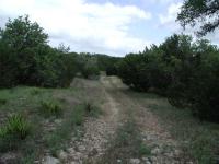
With one exception, the trails were devoid of people.
The trail is easy to follow and usually provides wide berth between the trees and shrubs, you you have to be careful in Pace Bend not from what's in the trees, but what's between them. On our trip we encountered numerous spider webs that completely spanned the trail. A dense center of several feet in diameter were held in place by support strands that extended the structure to outwards of 10-15 feet. Some of the webs contained spiders, waiting for dinner to drop in. A big web can hold a big spider, which these were. We could not identify the species of the spiders (something we need to work on) but can report that their diameter with legs were 2-3 inches across.

We got pretty good at seeing the web before running into them as we progressed along the trail. Sometimes we just walked around them, but occassionally we had to use a stick to clear the path. Sometimes it's a choice between tearing down a spider's web and trampling on some of the vegetation just off the trail.

One of the many spiders we saw.  Yes, this Tarantula is THAT big.
One of the many spiders we saw. Yes, this Tarantula is THAT big.
The web spiders were not the only ones visible on the trail. Crossing our path on this trip was a 5-6 inch in diameter Tarantula which you can see pictured on this page. It was the biggest spider that we had seen in the wild.

Just past the waypoint marked "Y-Right2" the trail comes to a "T" section. We turned to the right as that seemed to offer us the greatest opportunity to extend the hike longer. Further south at the waypoint marked "Side Trail" there is yet another excursion that we mean to investigate in the future. Chances are that this trail joins up with the "Pack Trail" drawn out on the topo map to the west of our trail.
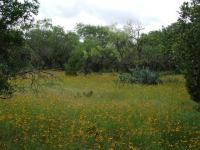
A field of Sunflowers and Prickly Pears.
We ran into something unexpected at the waypoint "Fenced Area". A small patch of land is fenced off with what appears to be a water tank and building inside. Nothing else exists around here and the only roads leading to it are the jeep trails on which we are hiking. It does not appear to be abandoned and seems like it should be in working order. On our topo map you can see the circle that we made around the perimeter of the fence during the day.
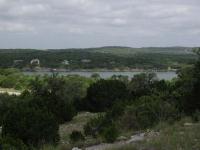
One of the few views of Lake Travis available on the trail.
We went clockwise around the fenced area and then found a trail that continued to the south east. This trail proceeds down a small creek valley towards our second trailhead of the day. At "Road1" we ran into the paved road that circles the park. We turned back and then took another spur that headed southwest towards yet another trailhead at "Road2". Along the way we experienced some rougher trails that were more overgrown than the other trails.
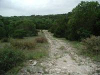
The slopes on the trail are not too severe, but after 5 miles even small climbs start to get tiring.
At this point we decided to head back toward our trailhead and call it a day. On the way back we investigated the western side of the fenced area and found just about the only decent lake view to be found on the hike. At "Scenic View" the sparser foliage and steeper incline provides a nice view of the lake and some of the large houses that line the shore on the opposite bank. There are plenty of signs of additional, smaller trails that start from this point and head to the north and south along the ridge. This might provide many more lake views than we were afforded on our trip.

When we returned to the large "T" in the road near "Y-Right2" we continued to the east to see where the trail ended. At "Road3" we found yet another trailhead than runs right into the main park road.

Pace Bend hiking is not supported by an intensive support program that includes convenient parking, detailed park tails maps and guided tours. For some, that may make this park all the more interesting and challenging. During our hike of 6 miles and 4 hours we saw only other group, a man and two children on the entire trail. For solitude, Pace Bend is hard to beat.

Photos
A typical stretch of trail
Lots of trail like this--grasslands dotted with cedars. (Photo by plectrudis)
A touch of whimsy--a hat tree in the middle of the trail
If you've lost your hat or water bottle, check here. (Photo by plectrudis)
One of the pleasant wooded bits
The path runs through several sizable cedar brakes. (Photo by plectrudis)
One of the nicer views from the trail
From most overlooks, you can only see a tiny sliver of lake, so this isn't a good choice if you're looking for spectacular vistas. (Photo by plectrudis)
Yet Another View Of The Trail
This is another view of one of the many trails. (Photo by Blaze)
Another View Of The Trail
Some parts of the trail offer small hills to climb. (Photo by Blaze)
Lake Travis
This view of Lake Travis was taken from some high cliffs close to the trail. (Photo by Blaze)
View Of The Trail
This is a typical view of the trail. (Photo by Blaze)
Log Entries
Lack of signage turned this into a death march
By plectrudis on 1/15/2018
Rating: 2stars Difficulty: 2stars Solitude: 3point5stars
Distance: 11.70 Miles Duration: N/A
If it were possible to navigate the trails in this park, it would be a pleasant fall/winter/spring hike, with plenty of trail available for long, medium, or short hikes. Nothing spectacular, but pleasant, if fairly standard, hill country grasslands and cedar woods. There is intermittent cover, but not nearly enough to make a July or Aug hike enjoyable. BUT. The whole thing is really poorly signed, the map doesn't even show parking lots or trailheads, and there are a number of gnarly trail junctions that are very difficult to navigate without signs. We lost our trail, we lost our car--what was supposed to be a 6-7-mile hike ended up being an 11.7 mile hike. Not fun. We'd probably still be there, wandering helplessly, if a very kind pair of trail runners hadn't spotted us, guessed that we were lost, and led us back to civilization. If you live in the area, it's probably worth learning your way around, but bring twice the amount of water you think you need, a fully charged cell phone, and, preferably, a GPS unit. Oh, and drop a pin where you park your car. The Well/Weil trail--an old Jeep track--offers the fewest opportunities for misdirection, so I'd recommend doing your first hike there. Or just don't bother--Muleshoe Bend and Grelle are ~10mi away, are prettier, and are easier to navigate.
Beautiful February Day
By bspross on 2/18/2009
Rating: 3stars Difficulty: 2stars Solitude: 5stars
Distance: 5.00 Miles Duration: 1 hour, 50 minutes

We hiked Pace Bend on February 18th and I didn't wear a shirt.  You have to love Austin!  We did not pass anyone else, but it was a weekday.  The hike was supposed to be an up and back, but we ended up making it a loop by going down the road for the last mile to get back to our car.  There are a couple of minor hills that give pretty good views, but with Lake Travis low, it is not particularly pretty.  These trails are inside the road loop so there is never any water.


Brian Spross

www.stuffpeopleread.com

uneventfull hiking, nice cliff jumping
By haysinaustin on 6/1/2008
Rating: 2stars Difficulty: 1star Solitude: 4stars
Distance: 4.00 Miles Duration: 45 minutes

very nice spot to go if you want a nice sized cliff to jump off of. Trails were dry with not much to look at.

Pretty lousy
By mhutch85 on 7/10/2006
Rating: 2stars Difficulty: 1star Solitude: 2stars
Distance: 2.00 Miles Duration: N/A

This hike is disappointing -- there is very little tree cover and not much else to see nature-wise. The camping isn't much better. What is good, however, is the swimming in Lake Travis. There are a couple areas where it is safe to jump off the cliffs. This, in my opinion, is the main reason to visit the site.

Nice lake view
By pixistixs on 6/15/2005
Rating: 3stars Difficulty: 1star Solitude: 2stars
Distance: 1.00 Mile Duration: N/A
Didn't do much of the trail but you can jump off the cliffs or take the grassy side easily down to the water. Camping is primative but a moonlit view of the lake is healing like chicken soup.
Not much to see
By jorge1000xl on 1/24/2005
Rating: N/A Difficulty: 2stars Solitude: 5stars
Distance: 4.00 Miles Duration: N/A
$8 admission is an awful lot for this hike.
Probably not worth the trip for the hike alone
By figment on 7/13/2003
Rating: N/A Difficulty: 2stars Solitude: 5stars
Distance: 2.00 Miles Duration: N/A
I was kind of disappointed in this hike, because there wasn't much to see, and there are easier places to get to if you want to hike on Hill Country savannah here in Austin. Also, this is definitely a park for a shady or cool day, there isn't a lot of shade. On the plus side, there are about 15 different places to go swimming in Lake Travis here, and some of them looked like very inviting coves.
Quiet early in the morning.
By Centex Trekker on 6/14/2003
Rating: N/A Difficulty: 3stars Solitude: 4stars
Distance: 1.00 Mile Duration: N/A
Most folks don't start showing up until noonish.
Miles and trails and lots of solitude
By Austin Explorer on 6/3/2001
Rating: 2stars Difficulty: 3stars Solitude: 4stars
Distance: 6.00 Miles Duration: N/A
About as empty a trail as your likely to find in the area. The vast majority of folks use this park for the lake access and few venture into the center of the park, at least not during our visit.
Recommended Item
Recommended Item 60 Hikes Within 60 Miles: San Antonio and Austin: Including the Hill Country
Charlie Llewellin, Johnny Molloy
List Price: $18.95 Your price: $11.96 Buy Now
It's Time to Take a Hike in San Antonio!

The San Antonio and Austin areas are steeped in history -- San Antonio's Alamo stands as a symbol of Texas' fierce independence, while Austin is recognized as the cradle of Texas statehood. This area is also known for some of the most impressive hiking in the Lone Star State. 60 Hikes Within 60 Miles: San Antonio and Austin, by veteran authors Charlie Llewellin and Johnny Molloy, guides readers to the best trails found in the Texas Hill Country, all within easy reach of these two cities. The guide takes you to secluded, low traffic areas as well as those that are more popular and heavily used. The former LBJ Ranch, the Guadalupe River, the Highland Lakes Chain, and the Lost Pines area are just some of the spectacular places covered.

With this new edition in the best-selling 60 Hikes Within 60 Miles series, all these visually stunning and ruggedly charming routes are at the traveler's fingertips. This handy guide helps San Antonio and Austin natives get back into nature, with many options right in town. Extensive at-a-glance information makes it easy to choose the perfect hike based on length, difficulty, scenery, or on a specific factor such as hikes good for families, runners, or birding. Each trail profile includes maps, directions, driving times, nearby attractions, and other pertinent details.