I went hiking in the San Antonio area with a buddy. Guadalupe River State Park was our first destination. We camped in the primitive area and it was cooooold at night (mid-30's).
The fire wood we bought from the rangers was damp and very difficult to light. After going through almost all of my waterproof matches, I finally cheated and used my butane stove to help ignite the wood. After a few minutes of brute force of blue flame, I got the fire started but it was so brisk you couldn't feel the warmth of the fire unless you hovered right next to it.
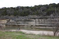
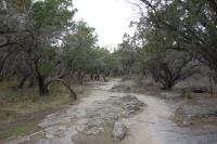
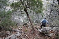
As far as the trails go, there are some nice spots, especially along the river. However, I found most of the trails a little disappointing. There are large sections of land where it looks like a war zone due to so many fallen trees everywhere. I later learned from a friend that lives in San Antonio that the Park Service intentionally knocked down most of the cedars as a part of a water control effort. Apparently the cedars suck up and hold a lot of ground water causing the water level to fall in nearby wells. In the past, the number of cedars were controlled by occassional natural wild fires, but since fire prevention efforts have been implemented the population of cedars has exploded. After knocking the cedars down they've seen water levels rise in the wells.
Having said all that, it still an eye sore to see so many down trees. It really screws up any photos you take. It would be nice if they removed the trees, cut them up into fire wood, or shredded them into mulch.
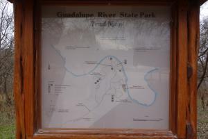
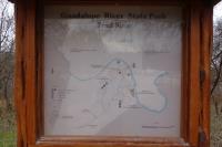
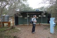
I also found the signage to be very poor. Since there are a lot of informal/undocumented trails and roads running all over the place, the map they give you at the Park HQs is fairly useless. I finally gave up and just walked around with my friend, but the park could benefit tremendously if it were maintained better.