Barton Creek - Upper South

Trail
5.50 Miles
N/A
Free
3point5stars (3.77)17
2point5stars (2.50)
2stars (2.21)
N/A
Yes
Yes
No
Austin
Travis
More Info

Getting there: From south MoPac, take the Loop 360 exit and head east. The first light includes a left turn lane which leads you into a parking lot for the office building next to the trail entrance. Try to park as far to the left, close to the greenbelt entrance as possible.

The Hike: The start of the trail is marked on the map with the waypoint labeled "Trail Head". Here you'll find a large sign with a map of the entire Greenbelt.

The trails starts off by heading south west then west under MoPac and Hwy 360. The going here is fairly easy. As you can see from the topo map, it's fairly dated. It does not show MoPac South crossing Barton Creek. Trust us, it does.

The next waypoint on the trail is actually something that we explored on our way back to the start. There is a very rocky stream bed that leads into a small valley with a beautiful rockfall crevice on the face of the sheer wall to the right. It looks like layers of rock just collapsed and created a slanted ledge on which to perch. Unfortunately that spot was taken by a couple of other hikers when we passed by, so we'll have to revisit some other time.
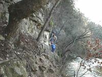
Chain crossing
Chain crossing
The trail is fairly easy to navigate, with the exception of a few areas, including the very narrow foothold that includes a chain drilled into the rock to add extra support. It's not too scary though. We saw kids go by there and dogs just ran across like there was no danger at all.

The main upper Barton Creek trail crosses the creek at Twin Falls. This is a popular gathering place for folks hitting the trail from either direction, so it can get rather crowded on nice days, as you can see from our photo. Nevertheless, it's a fine place to take a rest and have a snack. If you work your way a little downstream you can find a few nice rocks to sit on and listen to the water. Most folks seem to be interested in getting their feet wet at the falls themselves.
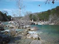
Twin Falls
Twin Falls
On our trip this day we decided to stay on this side of the creek and take the less travelled route that we were told led to some springs. So we continued and came to a water rapids we've marked as "Bank Falls" on the map. More rapids than falls the area is notable for being much less crowded than Twin Falls. It also includes a relatively wide bank of well rounded stones and even a small grassy bank. If you'd like to listen to water rapids but not hear as many people, this might be a good place to go.

The waypoint marked cave is really just an impression in the rock face. But, it makes for a fine place to stop and eat, which we did. The rock layers provide natural seating and you get a good view of everyone on the trail.

The trail crossed several streams that feed into Barton Creek. But none of them seem as interesting to us as the stream marked with "Slant Rock". This stream bed is composed of layers of rock that angled relative to overall ground and the light layer of rock is held up by a darker layer. As the light layered rock cracks it gives the distinct impression of a concrete slab breaking up.
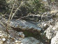
Slant Rock stream bed.
The waypoint marked "Spring" is the first of four springs that we found on this day. But you'll be rewarded with a nicer set of springs if you continue onward. When you get to "Twin Springs" you've reached the highlight of the hike. Two springs sprout about 5 feet apart and join in a small stream leading to the creek. The area immediately around the spring streams is teaming with small green plants. At this point, you're close to the end of the trail. Near the end you'll come across another spring, though we could not see it so much as hear it and see the stream of water working it's way to Barton Creek. The trail really starts to narrow and very soon will end in foliage. Time to turn back.

On the way back we spent a little time picking up trash that others left behind. In the end we collected a grocery bag full without exerting too much effort. As always, take all of your trash with you when hiking, but also take a little time to pick up a little extra. If we all did that we'd see no trash on the trails.

Photos
sculpture falls
the only water we found, (Photo by jimmy peace)
first falls
the first falls, dry (Photo by jimmy peace)
very dry
very dry barton creek (Photo by jimmy peace)
hole in tree
nature's art (Photo by jimmy peace)
Barton Creek | June 2, 2012
Took kids & dogs on our first (but not last) Barton Creek trail hike. (Photo by maddix)
off the main trail
from Best Buy (Photo by Caledonia)
Log Entries
Nice again
By texaskdog on 3/21/2015
Rating: 3stars Difficulty: 2point5stars Solitude: 2point5stars
Distance: 3.00 Miles Duration: 1 hour

As mentioned by another in 2010 they must have done something to the chain area as it does NOT look like it does in the picture.  I didn't like this one the other time we did it, 5 years ago, but liked it better with more rushing water this time.

very dry
By jimmy peace on 9/15/2013
Rating: 2point5stars Difficulty: 2point5stars Solitude: 1point5stars
Distance: 4.50 Miles Duration: N/A
57yo and finally, finally hiked to sculpture falls, yes a little water there but, only water we saw, i was quite impressed with the hike lots of people, at least wasnt any trash other than friggin bags left by dog owners with nasty in them
Nice, easy, day hike w/kids and dogs.
By maddix on 6/2/2012
Rating: 3point5stars Difficulty: 1star Solitude: 1star
Distance: 5.50 Miles Duration: 4 hours, 30 minutes
Took my children and dogs on a nice close by hike. Trail was nice and not difficult but still interesting. We went for the hike but will plan on more water activities on our next visit.
always a great trail
By Caledonia on 3/25/2012
Rating: 4stars Difficulty: 2point5stars Solitude: 2point5stars
Distance: 5.00 Miles Duration: N/A

parked at Best Buy and walked down to the creek.  Beautiful day and the water is flowing.

Lots of bikes
By Austin Explorer on 10/1/2011
Rating: 3point5stars Difficulty: 3stars Solitude: 2stars
Distance: 4.70 Miles Duration: 3 hours

Hiked to the springs at the end of the southern "shore" of Barton Creek with Madden Maniac.  Not much of a shore without any water other than the small springs there.  The trail is fairly dusty, but it was still nice to get outside and the weather is definately cooler now.

Encountered more cyclists than hikers, but generally had pleasant interactions with all.

By karawynne on 5/30/2010
Rating: 4stars Difficulty: 2stars Solitude: 1star
Distance: 3.20 Miles Duration: N/A
this hike was fun to do with friends. clearly, many people come here on the weekends with their families and friends to swim and enjoy the creek.
360 to underneath mopac and back
By barefoot mcgraw on 5/27/2010
Rating: 5stars Difficulty: 4stars Solitude: 3stars
Distance: 2.00 Miles Duration: 1 hour

this is one of my favorite bits of the greenbelt. i love the part with the chain! although i swear i remembered that section as more treacherous than it appeared today. oh well.

met a lost runner and hopefully helped direct her back to where she started.

inspired by this encounter, i now carry small (4x6") maps of the trail to hand out in case i meet more lost people in the future. i think i can explain it better on paper than by waving my arms around and saying "360 that way! mopac that way!"

i still need to complete the rest of the south side on a future hike.

Not as good as the rest of Barton
By texaskdog on 3/27/2010
Rating: 3stars Difficulty: 3stars Solitude: 2stars
Distance: 7.00 Miles Duration: 2 hours, 30 minutes

We followed the recommendation and its is a really nice trail in the chain crossing area (which is not even narrow as it looks in the pic) but after Mopac is fairly average, not close to the creek in most places, and it just dead ends in sight of sculpture falls.  Would be nice if you can cross to the north at Twin Falls and take the north side to Sculpture Falls and beyond.  We took a side trail that we thought looped around and it came out in Travis Country.  Still 3 stars but there are much nicer hikes on Barton Creek.  Mural under 360 is beautiful.

By Ollie on 1/23/2010
Rating: 5stars Difficulty: 3stars Solitude: 1star
Distance: 1.00 Mile Duration: N/A
Airman's Cave
By Ollie on 1/4/2010
Rating: 4stars Difficulty: 3stars Solitude: 3stars
Distance: 1.50 Miles Duration: 40 minutes

Just kind of stumbled upon it... very cool.

Only showing last 10 log entries. View All Log Entries

Recommended Item
Recommended Item 60 Hikes Within 60 Miles: San Antonio and Austin: Including the Hill Country
Charlie Llewellin, Johnny Molloy
List Price: $18.95 Your price: $12.59 Buy Now
It's Time to Take a Hike in San Antonio!

The San Antonio and Austin areas are steeped in history -- San Antonio's Alamo stands as a symbol of Texas' fierce independence, while Austin is recognized as the cradle of Texas statehood. This area is also known for some of the most impressive hiking in the Lone Star State. 60 Hikes Within 60 Miles: San Antonio and Austin, by veteran authors Charlie Llewellin and Johnny Molloy, guides readers to the best trails found in the Texas Hill Country, all within easy reach of these two cities. The guide takes you to secluded, low traffic areas as well as those that are more popular and heavily used. The former LBJ Ranch, the Guadalupe River, the Highland Lakes Chain, and the Lost Pines area are just some of the spectacular places covered.

With this new edition in the best-selling 60 Hikes Within 60 Miles series, all these visually stunning and ruggedly charming routes are at the traveler's fingertips. This handy guide helps San Antonio and Austin natives get back into nature, with many options right in town. Extensive at-a-glance information makes it easy to choose the perfect hike based on length, difficulty, scenery, or on a specific factor such as hikes good for families, runners, or birding. Each trail profile includes maps, directions, driving times, nearby attractions, and other pertinent details.