Spicewood Valley Trail Photos
Return to Spicewood Valley Trail
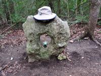
at the y to the rest of the trail (Photo by
jimmy peace)
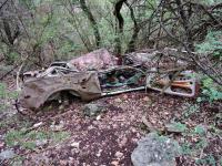
one of two wrecks along the trail, and still trying to figure how it got here unless by fllood long ago (Photo by
jimmy peace)
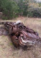
I'm assuming a flood is how this got here, but I want to know where it came from and how long it has been out there, rusting. (Photo by
heatharcadia)
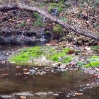
This natural waterfall was on the opposite side of the creek from the trail. It looks to be spring-fed (I didn't see another creek on the other side). (Photo by
heatharcadia)
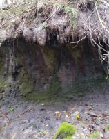
These probably aren't dripping all of the time, but the weather has been wet enough that there was a steady drip. (Photo by
heatharcadia)
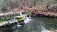
A nice waterfall over a dam. I could see a trail on the other side of the dam, but the water was flowing too much over the dam for me to cross without totally soaking my shoes and socks. (Photo by
heatharcadia)
-small.jpg)
The start of the trail is just across the street from Mountain View Park. (Photo by
Austin Explorer)
-small.jpg)
The rugged terrain of the northern half of the trail required extensive stonework by volunteers to construct. (Photo by
Austin Explorer)
-small.jpg)
The trail parallels a ridge of rock in the northern part of the park. (Photo by
Austin Explorer)
-small.jpg)
The southern half of the trail is flatter. Even here some stonework can be found in the form of stone benches in the distance. (Photo by
Austin Explorer)
-small.jpg)
This man-made waterfall on the trail is an older example of stonework in the area. (Photo by
Austin Explorer)
-small.jpg)
In the southern reaches of the park the path turns into a jeep trail and the vegetation gives way to the open sky. (Photo by
Austin Explorer)