Bastrop State Park
Information courtesy of the Houston Orienteering
Club and Michael Braun
Last update: December 9, 2001
The park is about 30 miles east of Austin. There is a park user fee of $3/person/day or $50/car/year.
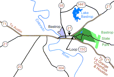 Area Road Map
|
From Austin: Take Hwy 71 southeast through Bastrop.
Go north on Hwy 95, then northeast on Hwy 21 to the park entrance.
From San Antonio: Take IH-35 north to San Marcos.
Go southeast on Hwy 80, then northeast on Hwy 21 through Bastrop to the park entrance.
From Houston: Take IH-10 west.
One mile past Columbus take exit #695 to go northwest on Hwy 71.
Just before Bastrop, bear right on Loop 150 to the park entrance.
|
|
Over 100 permanent controls have been installed in the park. The controls are white fiberglass posts about 1 meter tall.
Due to vandalism, some controls may be missing.
Orienteering maps (with or without the permanent control locations shown) are available at the park entrance for $3 each.
Please buy your maps from the park as it supports the installation and maintenance of the permanent controls.
Call the park office to verify that maps are in stock and will be available when you arrive. (512-321-2101)
|
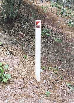 Permanent Control
|
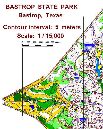
An Orienteering Map of Bastrop State Park
|